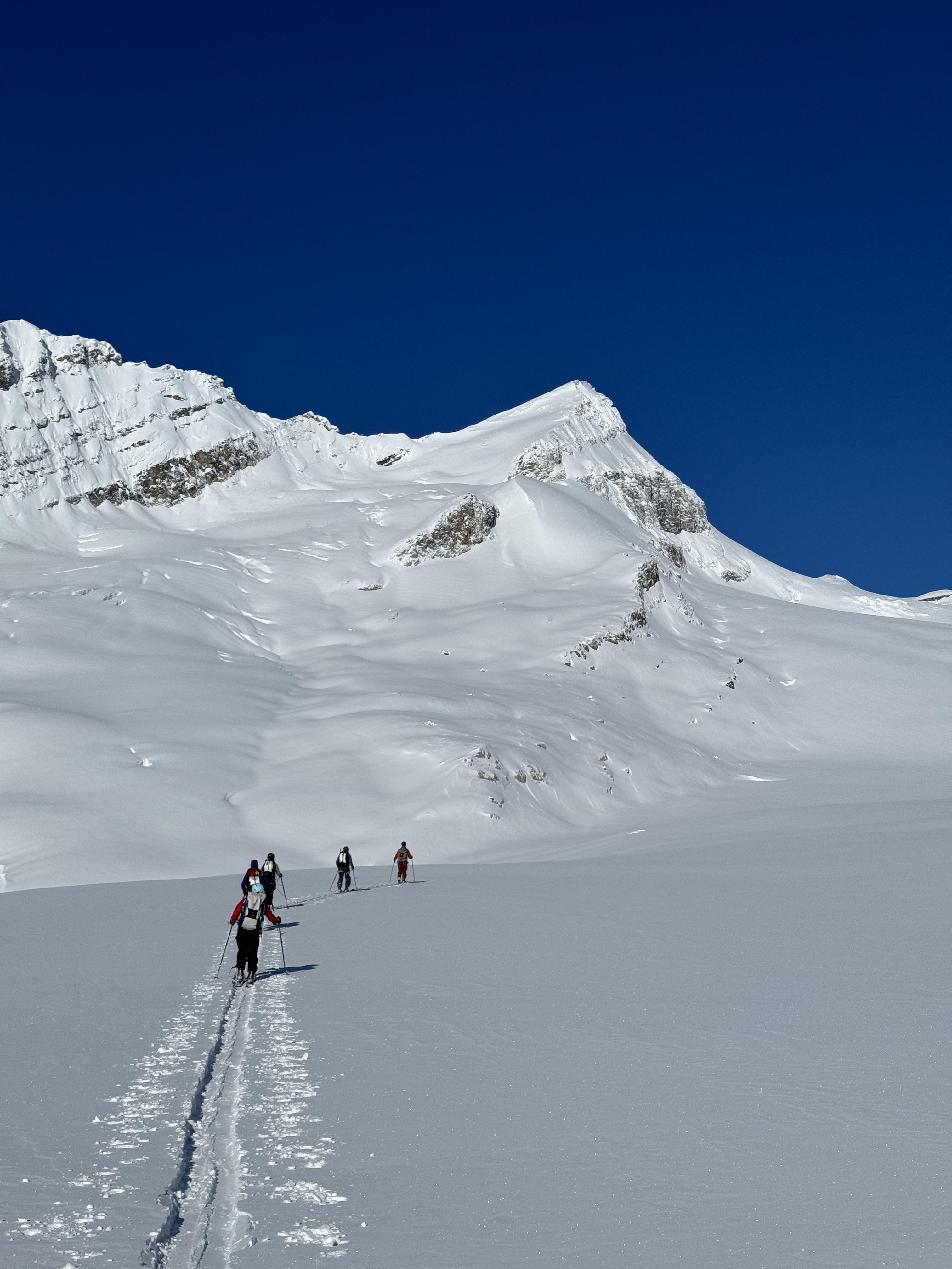
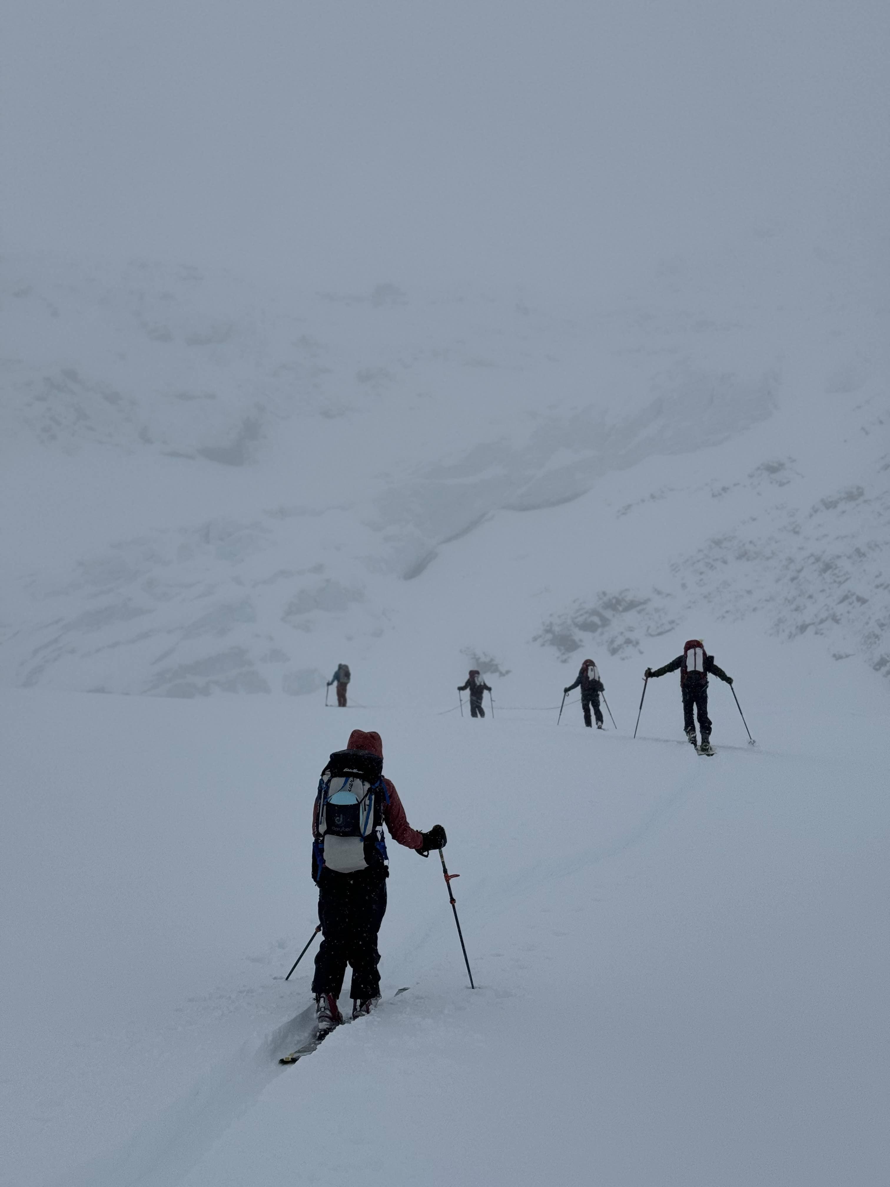
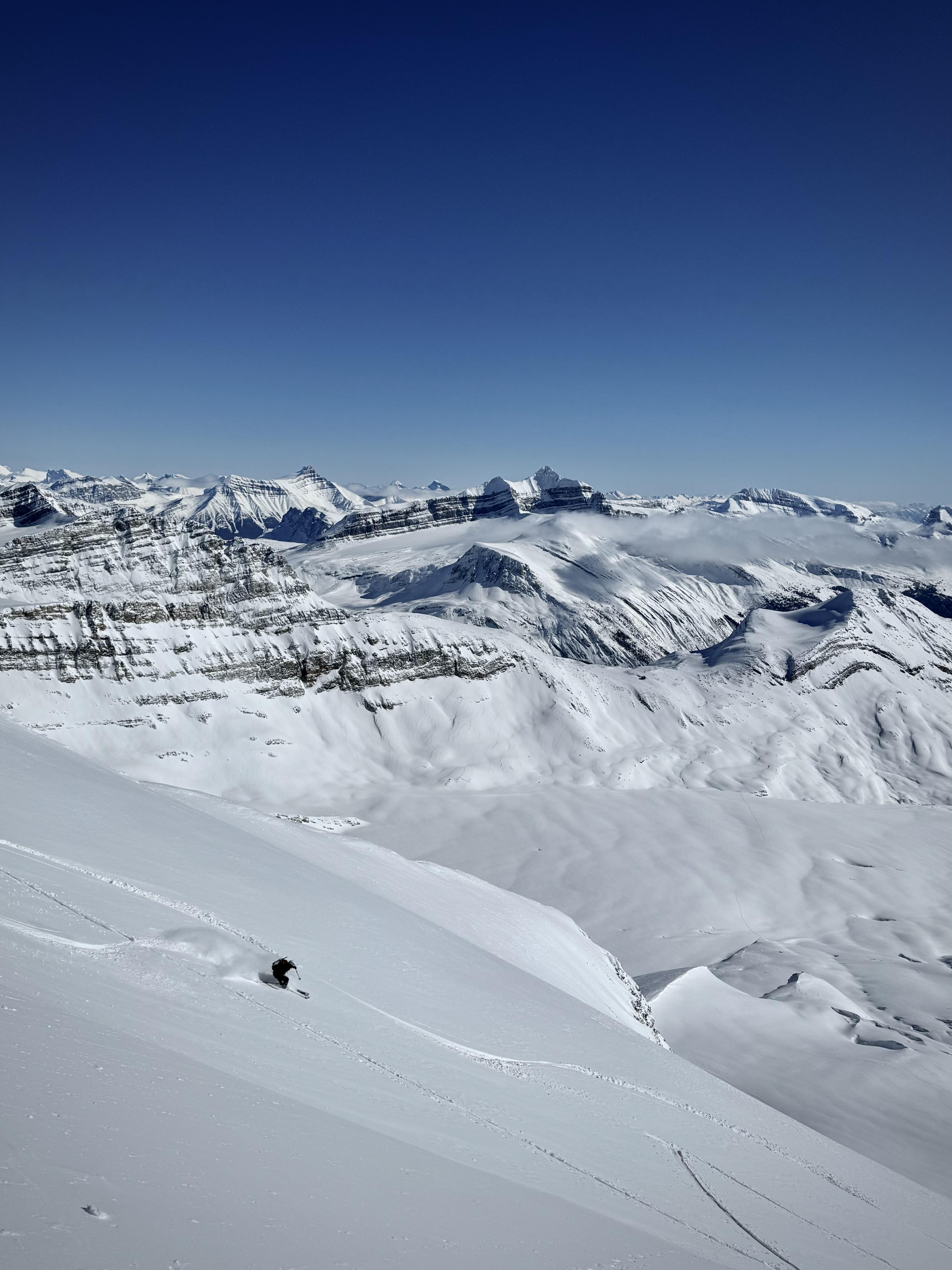
Just finished guiding a Bow to Yoho traverse last week for On Top Mountaineering. In classic Wapta fashion, we encountered whiteout nav, frigid temps, elevated avalanche hazard and cold skiing on windboard. We also had bluebird days, pow skiing, and solitude across the entire traverse!
We left the parking lot in the midst of a Western Canada-wide SPAW, and there was plenty of evidence of persistent problems in the Canadian Rockies. There are also retreating glaciers, and back-to-back hot summers are taking their toll on snow/glacier coverage. As such, here is my report, as well as some thoughts as we race towards spring.
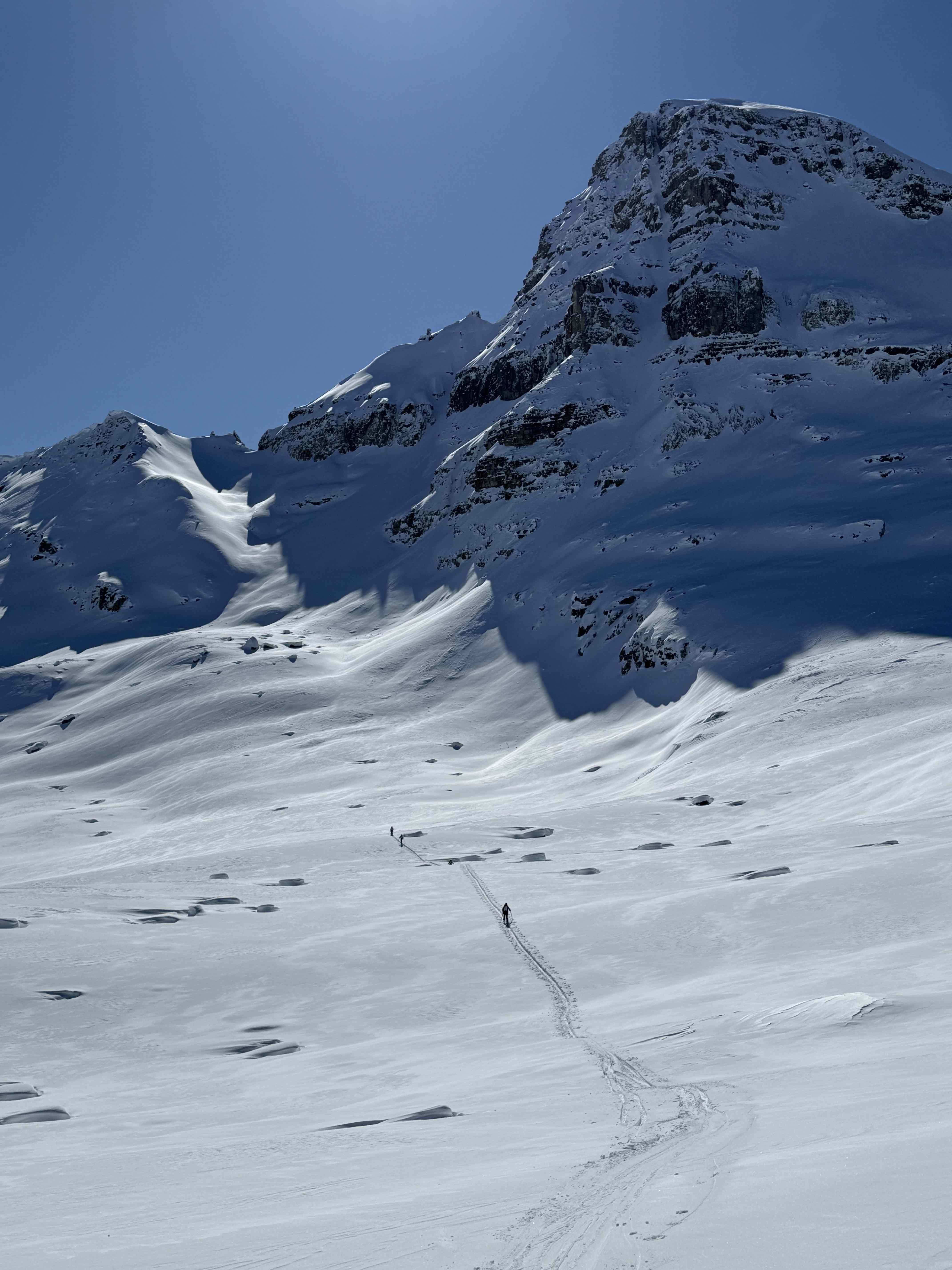
Glaciers: There are holes... lots of them! There were no show stoppers on the western side of the Divide, and the seasonal snowpack seems deeper on that side (unsurprisingly). In general, I was probing 200-250+ cm over the ice. The ascent under Mt Collie was undertaken in whiteout conditions, and while the track may not be in the perfect place, it seemed very reasonable as we probed over a bridge or two. Mt Des Poilus also had numerous holes on it, but again, we were able to negotiate an ascent of the peak. Our biggest challenge was negotiating the crevasse hazard in conjunction with an elevated avalanche hazard and uncertainty. Especially on Des Poilus, the easier pathways through crevasses were threatened by overhead hazard, and tracks needed to take into consideration holes as avalanche terrain traps.
As a side note, the lake that now exists below the Des Poilus Glacier is twice as long as the newest map datum show. :(
Avalanches: We encountered several parties in the Little Yoho Valley who had bailed on a Bow to Yoho Traverse to ski out of Stanley Mitchell Hut. Launching during an AvCan hazard of H/C/C certainly should give anyone pause, and as mentioned, we did see evidence of an unstable snowpack. However, I felt that with a Feb 3 PWL existing up to 2500 m, we could manage the hazard in a typical mid-winter fashion once we were above the Bow Hut. My biggest concerns were entering and exiting the Icefield traverse portion of the trip, and observations did bear this out. There were a couple high alpine avalanches observed around the Guy Hut, but these seemed more "predictable" (cornice triggered, and limited propagations) than the big PWL avalanches seen just above treeline/low alpine in the rest of the Alberta Rockies. (Caveat: we did not have any visibility from Bow to Guy).
From the Bow Glacier to Isolated Col, we did not have any whumphs, shooting cracks, or skier-triggered avalanches. Other than some sluffing from very steep terrain, we did not observe any new, natural avalanches either. A snow profile from below Isolated Col at ~2350 m showed 90 cm of dry, rounding snow on top of a thin (<1 cm) MFcr. Tests were unremarkable, with an ECTX and a CTH 26 (RP) failing below the crust. All these observations combined gave me confidence to take the group over Isolated Col.
All this said, conditions were still tricky for guiding, and on our descent from Isolated Col, we did remote trigger a size 2 avalanche (more on that later). A guided group who had just left the Stanley Mitchell Hut before we arrived wrote a trip report in the log book talking about widespread whumphing and remote-triggering avalanches during our same time period, and a extensive evidence of large avalanches occurring at that 2000-2400 m elevation band were present within the valley. We opted to finish our trip via the Yoho Valley, as I felt that the Iceline exit would pose significantly more PWL avalanche hazard than our traverse thus far.
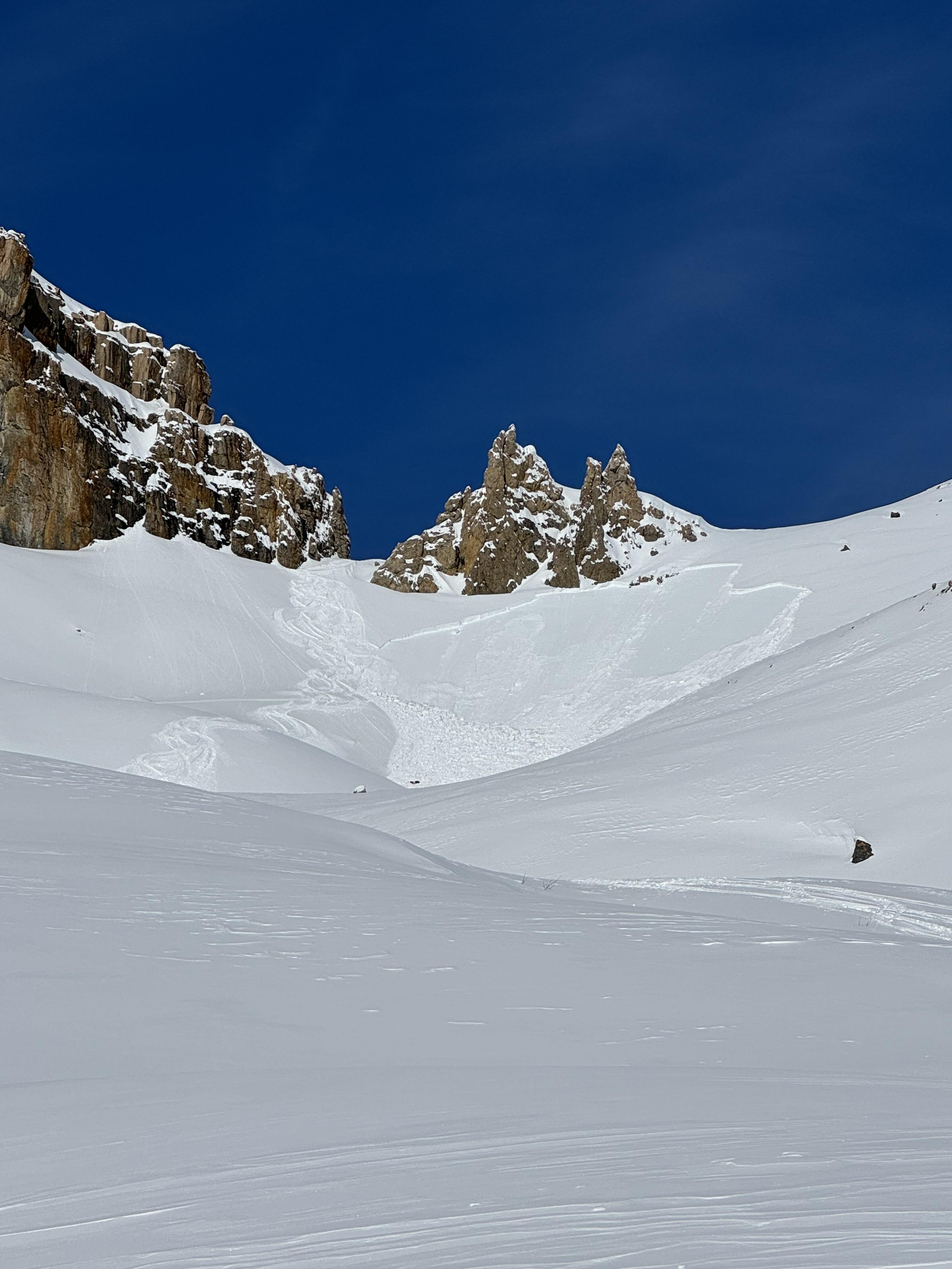
Isolated Col avalanche: Undoubtedly the crux of this trip, and a group following behind us with poorer visibility than we had, chose to circumnavigate Whaleback instead. Our climb from the north was definitely intimidating, and we mitigated the risk with standard guiding procedures (spacing out, regrouping in safe spots, etc). Ultimately, our ascent was uneventful.
On our descent, we did remote trigger an avalanche. The 4th skier, while stacking tracks towards the slope that slid, triggered the adjacent slope. Not realizing that she had started the avalanche, she made a few additional turns, before shouting alerted her to traverse right, away from any potential involvement. The avalanche ran ~80 m before stopping. A couple turns from the skier slid in the slab, but otherwise the avalanche ran adjacent to the ski run and did not overrun tracks on the ski line. The avalanche was a size 2, ~40 m wide with a crown height ranging from 20-70 cm (wind-affected) and consisted solely from the recent snow. It was on a SW aspect, in full sun, and ran on a non-dated sun crust, not the Feb 3 crust/facet combo.
Ultimately, my guests and I experienced a great trip, getting up high and travelling across amazing country! I did not finish the trip feeling as though we had undertaken an unreasonable amount of risk. That said, I had to make a lot of micro-decisions during the trip, and there is tricky travel throughout. These are not trips to be taken lightly this year, but with careful consideration, they may provide some awesome opportunities to be on skis in the mountains during this spooky period!
Dave Stimson, MG
Madeline Martin (practicum), CAA ITP L2